 loading
Arts & CultureObject lesson
Spheres of influence Abraham Kaleo Parrish is the head of the Map Department at Sterling Memorial Library.
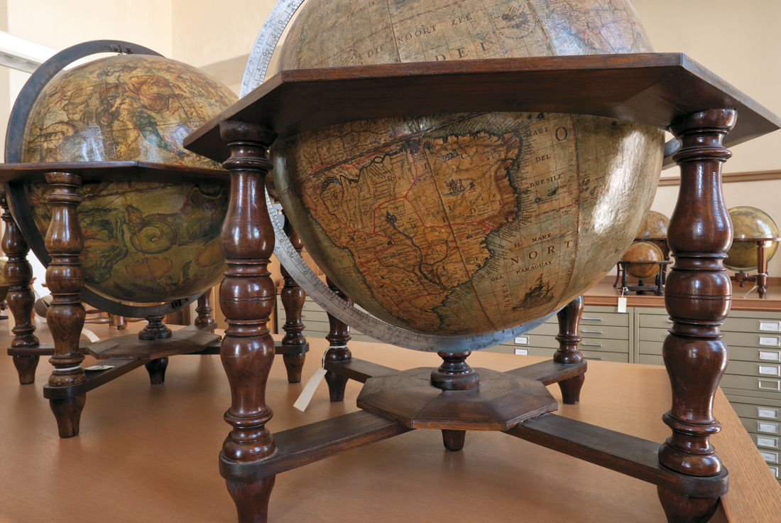 Mark MorosseThese two globes, with their copious geographic and decorative detail, were created by one of history's most celebrated mapmakers. View full image
These two globes, the largest in Yale’s collection at 19 inches across, are nevertheless among the smallest ever produced by the Venetian cartographer Vincenzo Coronelli (1650–1718), one of the most renowned mapmakers in history. A Franciscan friar who drew, engraved, and printed more than 400 maps, Coronelli made his mark with a giant pair of globes he built for Louis XIV, each 15 feet in diameter and weighing two tons. But these terrestrial and celestial globes, created in 1699 as a set, are magnificent in their own right. With their geographical and decorative detail, they are the jewels of the Lanman Globe Collection (donated in 1980 by Jonathan Lanman ’40, ’43MD, and housed in the map department at Sterling Memorial Library). They are constructed of papier-mâché, plaster, wood, metal, and varnished paper. For each globe, 24 wedge-shaped map segments were pasted to a papier-mâché sphere that had been covered with plaster. The terrestrial globe displays, for its time, extensive labeling of geographical names—in Italian, Spanish, Latin, Dutch, or English, as appropriate. The wooden horizon circle at the middle has a paper ring pasted on top that lists principal winds and principal directions, as well as zodiacal constellations, months, and saints. Coronelli’s representation of continents is surprisingly comprehensive, even though California appears as an island and Antarctica is just an imprecise land mass. The map’s many legends record major discoveries and expeditions, such as Magellan’s circumnavigation of the globe. Images of sailing ships, wrecks, indigenous peoples, seal fishing, architecture, and flora and fauna all enhance the cartography. The celestial globe depicts not only stars but also comets, fixed in their positions for the year 1700. A more decorative piece than its terrestrial twin, the globe is covered with elaborate illustrations representing the constellations. Woven through and around the figures are numbered stars, all keyed to a catalog Coronelli had published in 1693 of the names, locations, and magnitudes of 1,886 stars. Globes, because they distort distances and shapes much less than flat maps, are the truest maps of the earth. These two present a remarkably vivid model of the planet and heavens in 1700, and their decorative and pedagogic value is timeless.
The comment period has expired.
|

|
 Print
Print Email
Email